
I’ve decided on my hometown City of Spartanburg as the place that I’d like to help improve wayfinding and experience of walking through downtown. Though I am not often lost in Spartanburg, because I grew up there and know the area well, I have special insight to this area because my sister used to work for the city. I’ve talked with her about this project, and she is the source of a lot of my research. We are both Spartanburg lovers and truly want to see Spartanburg thrive and grow in the coming years, continuing the progress already made in downtown infrastructure.
In the time spanning my childhood to graduation, Spartanburg has grown tremendously, though slowly. In the past few years, however, downtown Spartanburg has undergone many changes and there has been a growth in small businesses and walkability of the downtown area. According to Spartanburg County Area Performance Planning (spartanburgcountyapp.org), Spartanburg is growing steadily. In 1990, Spartanburg had about 227,000 residents, but by the year 2030, there will be about 331,000 residents. This huge increase is due in part to the increase of large manufacturer’s setting up plants and locations in the Upstate of South Carolina, like BMW.
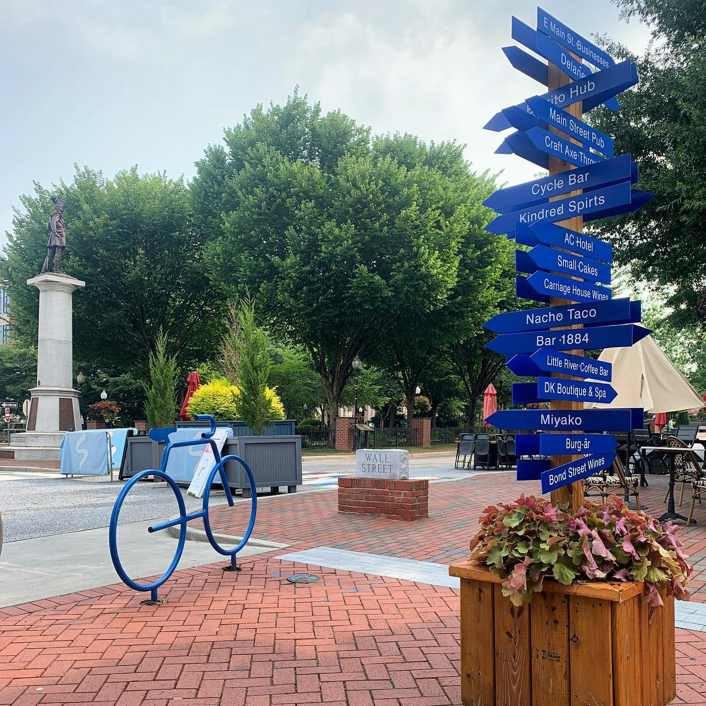
My sister told me of a meeting she had with Spartanburg county government officials walking through downtown and noting spots where they would like signage to be. She gave me insight that Spartanburg as a city has been interested in this idea since she worked there 3 years ago, and they still have not implemented anything to the scale of what they are wanting. There was one pole with arrow signs put right next to Morgan Square (town square) with businesses and landmarks placed on it, but this is more of a quick fix solution.As you can see, this sign is quite overwhelming and is trying to tell the viewer a lot of information at one time so it’s not easily digestible or comprehendible.
One benefit of this signage is, however, that the signs can easily be taken down or replaced if any business were to close or a new one were to open. This is something not so easily done on complex designed layouts of a city map. Therefore in more permanent solutions, it will be important to keep in mind the evergreen potential of all information being put on this board. Digital infrastructure could also help with this.
Looking at citywayfinding.com, I learned about different successful features of city wayfinding. They are:
Heads up Mapping: Giving the pedestrian information on where they currently are and what is currently in front of them, possibly coupled with a map that shows true north and how this are fits into the overall layout of the city.
Landmark building illustrations: a representation of well recognized buildings and landmarks. This also makes the city feel safer and more trustworthy.
5-minute walk circles: Showing what is within a 5 minute walking distance, creating a greater comprehension of map to city scale.
Off-Map Pointers: Showing important landmarks and destinations not on the map with a directional arrow.
Detailed overview map: This is a scaled overview of the entire city, with an opportunity to highlight landmarks, parks, statues, fountains, etc.
Progressive disclosure: Making sure that wayfinding points are digestible from different levels of distance, and create a smooth experience, readthrough, and communication of information. Using hierarchy, scale, and detail level to let people understand quickly or learn more with more time spent looking.
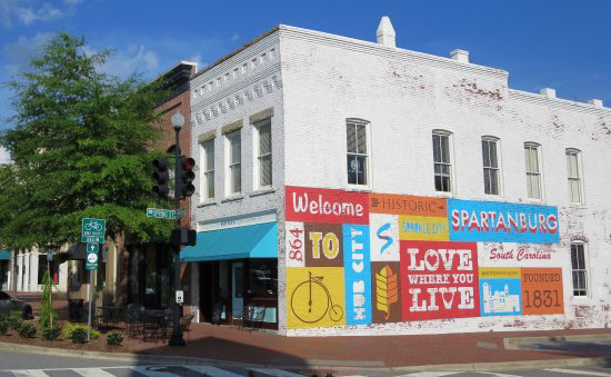
I’d really like to include illustration in my project, so I’m looking at a lot of fun and interesting ways of wayfinding, to see if there’s anything out of the box I could do. There are some fun examples of murals or sidewalk painting for directional arrows, and there are a lot of spaces in Spartanburg that are used for murals so that could be a good starting point. One of the more iconic murals is the Love Where You Live wall, one of downtown’s first murals. This is right next to main street Morgan Square, and my sister said this is one location where they were definitely considering placing a wayfinding location, signage, or kiosk.
Click Here a list of murals in Spartanburg for reference.
My first goal is to create illustrations for and develop a visual identity for the entire wayfinding campaign. Here are some landmarks I am initially thinking of: Wofford College, Converse College, Chapman Cultural Center, The Denny’s Building Headquarters (first skyscraper), the Montgomery Building, Historic Krispy Kreme, AC Hotel, the Police Department, and the Beacon. I also might focus on neighborhoods near downtown, like Hampton Heights or the Grain District. The City of Spartanburg often uses a sky blue in their marketing and government materials so I will probably base my color palette off of this blue.
Something to keep in mind is the location of signage cannot be a hindrance to pedestrians or cyclers. On the City of Spartanburg’s website, they have posted a Bicycle & Pedestrian plan, highlighting the city’s dedication to creating and implementing bicycle infrastructure downtown. They state, “The City was named the state's first Bicycle Friendly Community in 2007 and again in 2012”, so it is clear that the City places importance on this title and reputation. Signage and kiosks should not be placed in the path of pedestrians.